Culross and West Kirk

The next place I visited – this time with husband – was Culross. The palace gardens were used as Claire’s herb garden and then the town featured as the Cransmuir in the series. The study was Geillis Duncan’s house. It was a gorgeous day so we had a pleasant walk around the palace, gardens and town.

The Royal Burgh of Culross is a unique survival, a town that time has passed by. It is the most complete example in Scotland today of a Burgh of the 17th and 18th centuries. The Town House was built in 1626 and was the administrative centre of Culross with a tollbooth and witches’ prison. The old buildings and cobbled streets create a fascinating time warp for visitors. (NTS website)

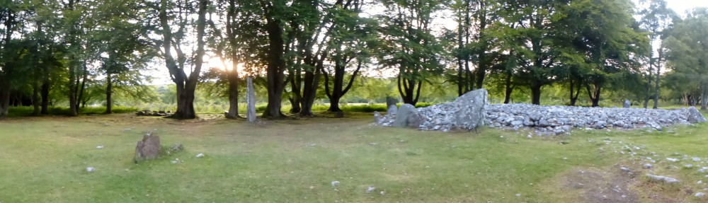
Our next stop was West Kirk which is just outside Culross. This was used as the Black Kirk in The Way Out. It was worth the walk, such a peaceful place.

Situated to the northwest of Culross in West Kirk Churchyard and surrounded by agricultural land, this was the former parish church of Culross.   It was replaced by the Abbey Parish Church  by an Act of Parliament of 1633.   However, it appears that the church had been out of use for some time before this, as the Act records that it was already in a ruinous condition.    The church is now roofless and a large tree grows inside the western end of the building and much ivy on the walls.   The graveyard is surrounded by low rubble boundary walls, which are in a poor state of repair in several places, and is entered at the southeast corner, where there are square gatepiers.   In general the graveyard is relatively flat but the church is on a slightly higher area on the northern side.   There is a large variety of headstones and table stones within the graveyard dating from the seventeenth -nineteenth centuries. The earlier monuments display symbols of death and mortality and a number of trades are also depicted, such as farmer, mariner and miner.

A late nineteenth century rectangular mausoleum is just outside the western edge of the graveyard, surrounded by sandstone rubble walls. There are three round arched openings in the northern, eastern and southern faces of the mausoleum, each of which is covered by decorative ironwork, but only those on the eastern face are accessible as gates. Each elevation is flanked by column shafts cut into the quoins. The interior of the mausoleum is largely overgrown but several memorial stones to the Dalgleish family are on the back (western) wall.

Source – www.scottishchurches.org.uk


Blackness Castle

After my trip to Prestonpans I decided to start visiting various filming locations from series 1 of Outlander. The first was Blackness Castle . The castle is situated on the banks of the River Forth. Called the ship that never sailed due to it’s shape. It is run by Historic Scotland. Despite it being so close to Edinburgh I had never visited the castle. It was worth a visit regardless of the Outlander connection.

Blackness Castle was used as Fort William in the series. It features in several episodes – Castle Leoch, The Garrison Commander, The Reckoning and Lallybroch. Flash backs of Jamie being flogged by Black Jack and Jamie rescuing Claire from Black Jack.

I spoke to the woman in the shop. The castle was used for about a month. She didn’t know if they used any of the rooms as she had not seen the tv series.

I enjoyed walking around the castle imaging where they filmed.

Built in the 15th century by one of Scotland’s most powerful families, the Crichtons, Blackness was never destined as a peaceful lordly residence; its enduring roles were those of garrison fortress and state prison. (Historic Scotland Website)

Information about visiting Midhope Castle (Lallybroch)

Recently I asked about visiting Midhope Castle on Outlanderish UK facebook page. Thanks to Anne Daly for the following information –
With an increase in visitors to Midhope/Lallybroch, here is the official guidance from Hopetoun Estates today. Tour Groups- please continue to phone or email in advance and then collect a pass- this is simply to control numbers. Individual visitors, please go to The Hopetoun Farm Shop (on the main road) and you will be issued with a pass and directions if needed. The Fireworks people are not keen on visitors using their parking area, so if it is a weekday during working hours, please park in the layby at the top of the road.

This will be reviewed at the end of the summer.

Prestonpans – viewpoint of the battle

The first week of the school holidays was glorious weather and I found myself driving in East Lothian. I recently read Dragonfly in Amber. In the book Jamie and Claire are involved in the Battle of Prestonpans – the beginning of the 1745 uprising. I had in the past seen the cairn that marks the battle but this time I discovered that there is a viewpoint of the battlefield. The photos show the view from the top of the hill. I brought my pocket Jamie with me.

After posting my photos on the Outlanderish UK facebook page a discussion was started and a tour of the battlefield has been organised for Saturday 11th July.

The Battle of Prestonpans is located to the east and south of Prestonpans across a large, mixed-use landscape. The battle, fought on the 21st September 1745, was the first action of the Jacobite ’45 rebellion and was a dramatic Jacobite victory. Prince Charles Edward Stuart (Bonnie Prince Charlie) was present at the battle, leading his army of plaid clad Highlanders against the redcoats of General John Cope.

The battle was fought in the early morning of the 21st and very quickly the government army was overwhelmed and routed. Terrified by the ferocity of the Highland charge, many of Cope’s army fled. The Government soldiers were pursued by the Jacobites for over a kilometre until many were trapped and cut down against the walls of Preston House and Bankton House. Some managed to find there way through the narrow defile running between the two parks or through breeches in the walls. Hundreds were killed in the aftermath and many were taken prisoner.

Much of the battle landscape still survives and the best way to experience the site is to either climb up to the top of the viewing mound at Meadowmill (take A198 off the A1 and follow signs for Meadowmill sports centre and Battle site) or follow the self-guided walk described in the battle leaflet downloadable from the following website www.battleofprestonpans1745.org.

Source – www.visiteastlothian.org